Your Bhutan journey is individually tailored to suit your taste, needs and timescale. This holiday ca takes you in to stunning Buddhist temples, monasteries and pagodas, at their best. To enhance your experiec JOMOLHARI (7.326m) BASECAMP TREK certainly gives you adventurous surprises to taste your physical condition and enjoy the breakthtaking view of 7314 m Hjomalhari from Jangothang. Jomolhari Base Camp trek in Bhutan also offer you some of the most spectacular sceneries of the Higher Himalayas and you explore the Himalyan Nature with opportunities to exotic & rare flora & fauna
Jomolhari Base Camp Trek
Highlight
- Visit Ancient temples, monasteries ,Dzongs (Forts)
- Take part in Archery matches
- Visit to pristine villages and farm house & local delicacies
- Scenic Mountain Landscapes
- Diverse Himalayan Flora and fauna
- Good Chance of sighting Himalyan Blue Sheep/Yaks and Himalyan Pheasants
- Yak Herders’ camp & Highland Yak Pasture
- Explore High Altitudes lake Tshophu from the Base Camp
- Breathtaking view of Mt. Jhomolhari & Mr. Jichu Drake
- Explore Jhomolhari Glacier
Trip Facts
Start & End Point
Paro/Paro
Duration
15 D/14 N
Best Time
Spring,Autum
Grade
Very Strenuous
Activity
Trekking, Camping
Accomodation
3* star Hotel , Tented Camp
Meals
14 Breakfast, 14 Lunch, 14 Dinner
Max. Elevation
4,080 m
Itinerary
Welcome to Bhutan, the Land of the Thunder Dragon!! Upon arrival in Paro, clear customs and immigration. Meet your Guide and driver outside the terminal building and transfer to Thimphu. Enroute, you will stop to visit Tamchog Lhakhang located at the other side of the river and connected by sacred suspension bridge dating back to 13TH century Saint Thangthong Gyalpo. Upon reaching Thimphu, If time permits stroll around the capital city.
Drive from Paro to Thimphu: The distance of about 65kms from Paro town takes about little more than 1 hour. Drive south following Pachu river to the river confluence at Chuzom, which is also the hub of road network going to Paro, Ha, Thimphu and Phuntsholing. From Chuzom, the drive takes about 1 hour, staying close to the Wangchu River in the valley floor, as you pass through villages and suburbs to the capital, Thimphu. En-route, you can stop to view Tachogang temple and the nunnery at Sitsina.
Accommodation
Pedling Hotel & SpaMeals
Lunch ,DinnerMaximum Altitude
2,300 mFull day sightseeing in Thimphu.
Visit Memorial Chorten, Takin Sanctuary, Buddha Point, handmade paper factory and weekend market. Towards end of the day visit Tashicho Dzong.
Memorial Chorten: This landmark of Thimphu was built in 1974 in the memory of third King, Jigme Dorji Wangchuk, who is popularly regarded as Father of Modern Bhutan. It is a four-storey tall white building, containing statues and iconography of deities from complex tantric teachings and serves as an important place of worship for Thimphu residents, as well as from other parts of the country.
Takin Sanctuary: Takin (Budorcas taxicolor) has been chosen as the national animal of Bhutan is based both on its uniqueness and its association with country’s history and mythology. It is said that Devine Madman, a popular saint is said to have created it with his magical power at a large congregation of devotees. It resembles like a cow from back and goat in the front and continues to befuddle taxonomists, who cannot quite relate to other animal.
Buddha Point: This is a new monument and main highlight of Thimphu valley. It has 165 meter high Buddha Statue
Paper Factory: Traditional papers were made from the daphne plant, using simple methods.
Weekend Market: The colorful weekend market of Thimphu is held from Friday-Sunday. Residents of Thimphu and country sides come to shop for food and clothes. There are some handicrafts and gifts shop as well, and provide a great photography scene.
Tashichhodzong: This fortress serves as the office of the King, ministers and various government organizations. It also is the headquarters for central monastic body of Bhutan. Bhutan's spiritual leader Je-Khenpo and the monks of both Thimphu and Punakha reside here during summer. It is also the venue for Thimphu Festival in the fall season.
Accommodation
Pedling Hotel & SpaMeals
Breakfast, Lunch, DinnerMaximum Altitude
2,300 mDrive to Punakha (3 hours drive). In the afternoon, easy hike to the Fertility Temple (Chimi Lhakhang) and visit historical Punakha Dzong – the sacred site of Royal Wedding. Overnight hotel, Punakha.
Drive from Thimphu to Punakha/Wangdue: The drive from Thimphu (75kms) takes about 3 hours. The road climbs from Thimphu to Dochula pass and descends through ever changing forests into the semi-tropical valley of Punakha and Wangdi at around 1200m. En-route stop at Dochula pass (3050m) where you can view the eastern Himalayas, including Bhutan's highest mountain, Gangkar Punsum (7,550m).
Fertility Temple (Chimi Lhakhang): a monastery and fertility temple dedicated to Lama Drukpa Kuenley, a Tibetan Buddhist saint known popularly as “the divine madman” and considered a folk hero in Bhutan for his unconventional ways. Drukpa Kuenley originally built a chorten on the site in the 14th century, on which a temple was later built in 15th century. The temple, flanked by nearly 100 tall prayer flags, sits atop a picturesque hill. It has long been a pilgrimage site for childless couples. This easy walk takes about ½ hour each way.
Punakha Dzong: or Pungthang Dechen Phodrang "Palace of Great Happiness" popularly known as Punakha Dzong, located on the confluence of two rivers; Pho and Mochu was built in 1637 by Shubdrung Nawang Namgyal. It serves as winter residence for the Central Monastic body, which migrate from Thimphu to Punakha in the winter. It is also the venue for Punakha Festival held in February or March.
Punakha and Wangdue: Punakha and Wangdue, although two separate districts, are located in one valley (20km/ ½ hr drive apart) and they are at the lower elevation of about 1,250m with pleasant winters. Cactuses, Oranges, bananas and sub-tropical plants are found here. Punakha was once the winter capital of Bhutan, the tradition that is still held by the Central Monastic body.
Accommodation
Hotel LobesaMeals
Breakfast, Lunch, DinnerMaximum Altitude
3,000 mAfter breakfast, drive to Phobjikha. Enroute stop at old Wangdiphodrang town and visit huge Wangduephodrang Dzong and continue uphill drive to Phobjikha. Overnight hotel, Phobjikha.
Drive from Punakha to Phobjikha: Drive to Gangtey (Phobjikha) takes about 2 ½ hours covering distance of 60 km. The road climbs from Wandue, drive uphill almost crosses over Pele La pass 3400m. Before, reaching the pass, the road diverges and we take the road least traveled by. This eventually leads into the 'hidden valley' containing the stunningly beautiful monastery of Gangtey Gompa.
Black-necked Crane: ‘Thrung Trung Karmo’ as this bird is passionately called in Bhutan is subject of many Bhutanese songs and folklore. They are seen among the painting on the walls of temples and Thankga. These endangered species of cranes migrate from Tibet in late autumn and typically stay till the mid march. About 3-400 cranes reside in the wetland in the center of the valley. The Observation & Education Centre (open 7-7pm – Mon-Fri) has informative display about the cranes and conservation effort in the valley.
Phobjikha Valley: Phobjikha (3000m) is a wide-glacial and beautiful valley, designated as conservation zone within the Black Mountains National Park, a natural habitat for wildlife, including nesting black-necked cranes from Central Asia (mid autumn till early spring). Because of the conservation measures, there is no electricity in the valley. The lodges use solar powered cells or generator to light which is turned of after dinner. Hot water is provided in the bucket and rooms are heated with wood stoves.
Accommodation
Dewachen Hotel & SpaMeals
Breakfast, Lunch, DinnerMaximum Altitude
3,000 mPhobjikha is one of the most beautiful place in Bhutan and designated as conservation zone. This valley is also considered sacred due to the presence of endangered Black Necked Crane in the winter season. Spend your day visting Gangtey Gonpa, the Blacked-Naked Crane center and exploring the flat beautiful valley and traditional village untouched by modernity.
Gangtey Gompa: Gantey Gompa monastery sits atop a hillock that overlooks the Phobjikha valley. It is headed by the ninth Gangtey Trulku and is the largest Nyingma monastery in western Bhutan. It was founded in 1613 by Gyalse Pema Thinlay, a grandson and reincarnation of influential treasure finder Pema Lingpa. Incarnate line of Pema Thinlay, representing the body aspects of Pema Lingpa, contrasted with mind and speech emanations. The monastery has been recently built and surrounding the monastery are village homes and hermitages.
Endangered Black-Necked Crane Information Centre : The centre displays about the cranes and the valley environment. You can use the centre’s powerful spotting scopes and check what you see against its pamphlet ‘Field Guide to Crane Behaviour’. If the weather isn’t good, you can browse the library and handicraft shop, and watch videos of the endangered birds, its habit and habitat. This valley is also one of the pioneer centre ecotourism in the country .
Black-necked Crane: ‘Thrung Trung Karmo’ as this bird is passionately called in Bhutan is subject of many Bhutanese songs and folklore. They are seen among the painting on the walls of temples and Thankga. These endangered species of cranes migrate from Tibet in late autumn and typically stay till the mid march. About 3-400 cranes reside in the wetland in the center of the valley. The Observation & Education Centre has informative display about the cranes and conservation effort in the valley.
Accommodation
Dewachen Hotel & SpaMeals
Breakfast, Lunch, DinnerMaximum Altitude
3,000 mAfter breakfast, drive to Paro. In Paro, you will visit National Museum, Rinpung Dzong, Kyichu Lhakhang and Traditional Bhutanese Farm House in the village.
National Museum: Established in 1967, the museum is housed inside a circular Ta Dzong, an ancient Watch Tower. It holds fascinating collection of arts, relics, religious thangkha paintings, households stuffs, arms, handicrafts, stuffed animals and Bhutan’s famous Stamps among others. (open 10-4pm – closed on Monday).
Rinpung Dzong: meaning "fortress of the heap of jewels". Built in mid 17th century, it now serves as the administrative and judicial seat of Paro district and residence for the 200 monks of Paro. It is also the venue for Paro festival held in the spring. Several years ago, the colourful movie Little Buddha was filmed here.
Kyichu Lhakhang: Tibetan King Songtsen Gompo in the 7th century miraculously built 108 temples, along with Jorkhang in Lhasa. Kyichu is considered to be one of them and is one of the oldest temples in Bhutan.
Farm House or Village Home: Bhutanese farmhouses are colorful, decorative and traditionally built without any nails. Majority of the houses are with three story, first floor is utilized for sheltering cattle, second floor for the family to live in and the top for storing and drying of foods and fodder for animal. Almost all the farmhouses follow the same architectural pattern. A visit to farmhouse is interesting and provides you with an experience to the daily life of average Bhutanese.
Drive from Thimphu to Paro: It takes about 1 hour to Paro from Thimphu. The western branch of lateral highway from Thimphu, runs close to the Wangchu river in the valley foor, through the suburbs and villages of Thimphu to arrive at the river confluence of Chuzom, which is also the hub of road network going to Paro, Ha, Thimphu and Phuntsholing. From Chuzom, it is north-west for about ½ hour, following Pa Chu river upstream, passing Tachogang temple on the other side of the river, then through relatively straight road, into the villages and farm houses of Paro valley.
Paro: Paro is one of the most beautiful valleys in the country with Bhutan’s only airport located here, among the terraced fields, and elegant farm houses. Willow trees line many of the roads, contrasting with bright colors of the fields and the most popular and important sites also found within Paro district. Paro town (2,280m) is still a small with one main street and less than one hundred small family-run shops. The weekend market in Paro is held on Saturdays.
Accommodation
Mandala ResortMeals
Breakfast, Lunch, DinnerMaximum Altitude
2,280 mAfter breakfast, hike to famous Tiger’s Nest Monastery. After completing the hike drive to Shana for 2 hours. Overnight at camp in Shana.
Hike to Taktsang (Tiger’s Nest Monastery): Drive north of Paro town for about ½ hr and embark on a trek to the famed Taktsang (Tiger’s lair) monastery. Taktsang monastery is located on the face of a 1,000m seemingly impossible sheer, vertical cliff, above Paro valley. The trail begins near the Satsam (2650m) and climbs steeply uphill to the Cafeteria (2,940m), an area of exposed ridge with panoramic view of Takstang. This takes little more than an hour. (Ponies are provided on request to ride up till this Cafeteria, but rest of way, including return downhill must be on foot.) You can get a good view from the Cafeteria or hike further uphill for another hour or so to the main temple itself. There are several other temples and sites within the vicinity. Lunch can be taken at the tea house. The return trek to the road where we started the trek is quite steep downhill to the point where you will be met by your driver who will drive you to SHANA.
DRIVE TO SHANA: drive to Shana 2 hours following the river gently uphill through a narrowing valley of paddy fields. You will find plenty of traditional farm houses in a purely rural setting. The camp site is just beyond an army outpost.
Accommodation
Tented CampMeals
Breakfast, Lunch, DinnerMaximum Altitude
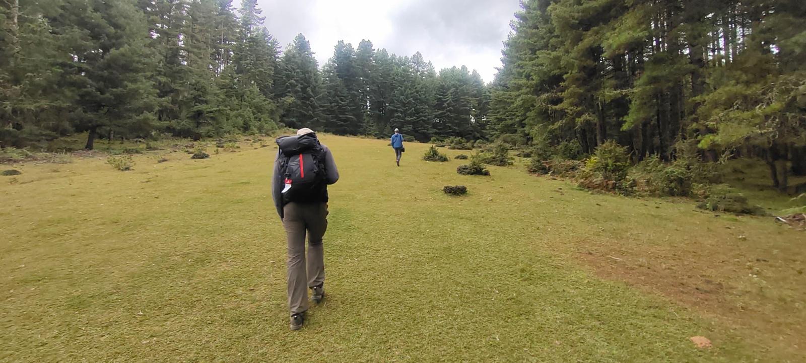
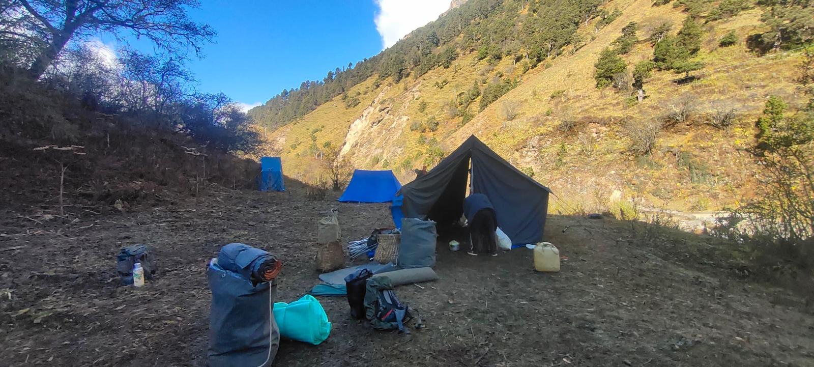
2,800 mContinue uphill through the river valley which narrows and closes in after some distance. The trail then winds up and down along the drainage. Most of the trail actually is down hill after the initial climb. The camp site is located in a meadow with stone shelter.
Accommodation
Tented CampMeals
Breakfast, Lunch, DinnerMaximum Altitude
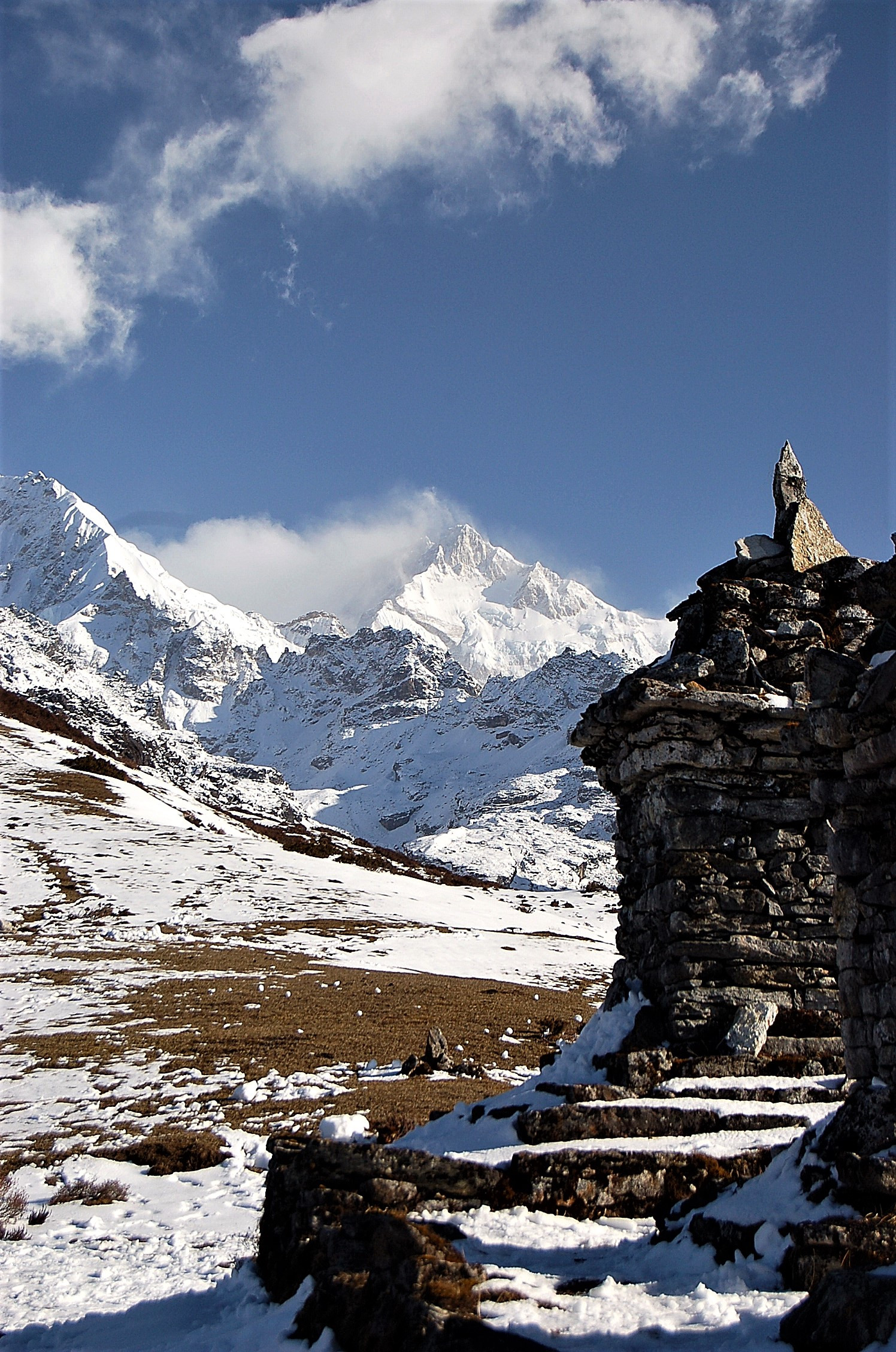
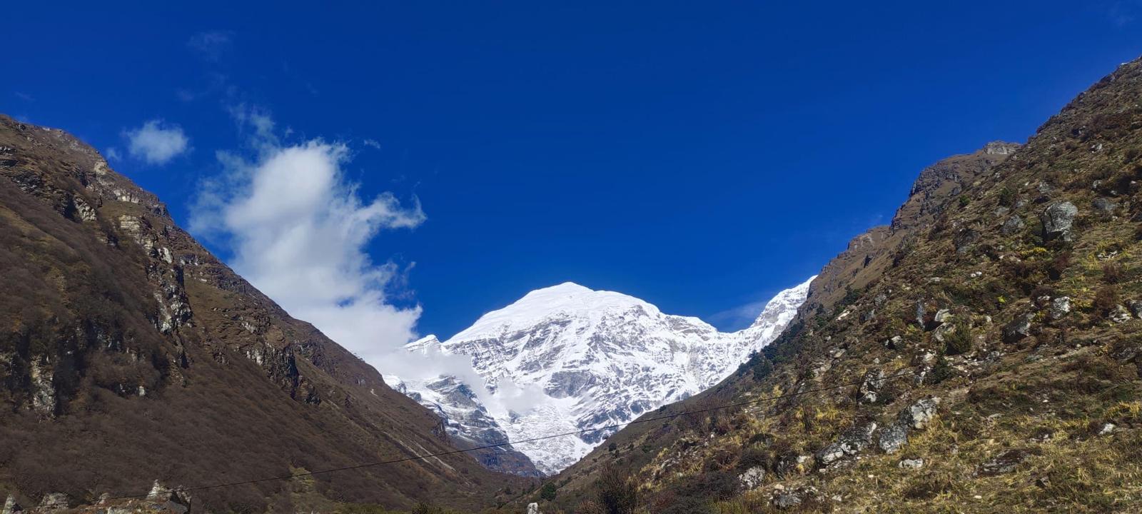
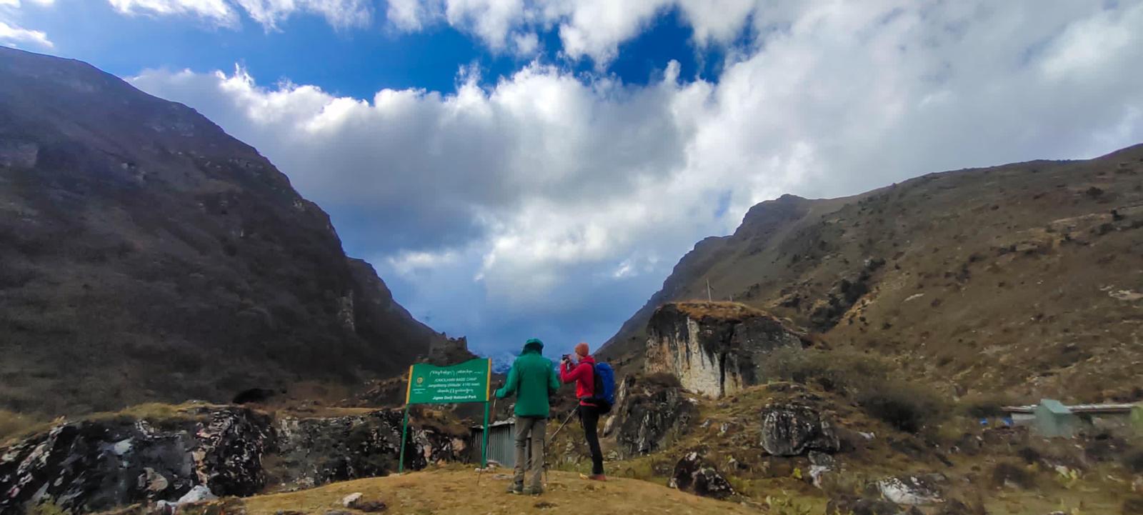
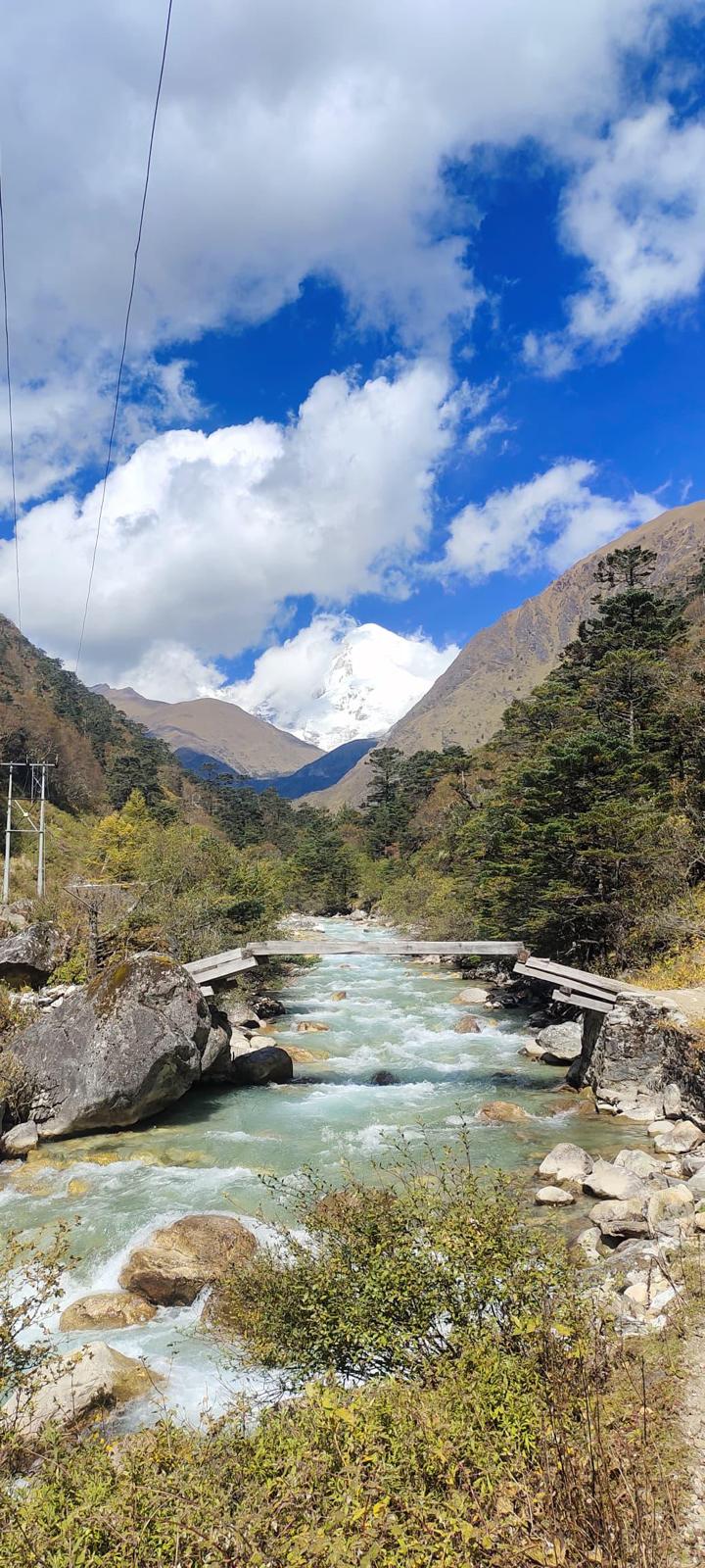
3,400 mWalk up along the Pachu (Paro river), pass a small army outpost where the valley begins to widen again. You can now clearly view the high ridges and the snow capped mountains all around and also see the yaks and the yak herders winter homes. Camp beneath a ruined fortress at the base of the Chomolhari mountain. Alt. 4040m. Distance 19 km and time 5-6 hours with 480 m ascend. The views of Jhomolhari and Jichu Drake are superb from the Camp.
Accommodation
Tented CampMeals
Breakfast, Lunch, DinnerMaximum Altitude
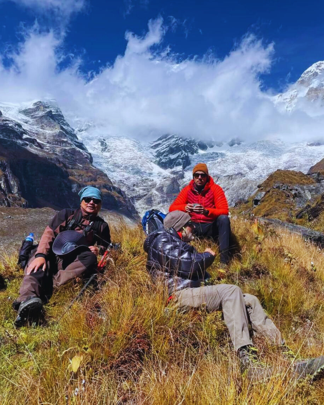
4,040 mTwo days in Jangothang is the highlight of the trek; the view don't get any better than here. Thare are lots of day hikes that you make and a day or two are very well spent exploring the surrounding hights & glacier lakes. Jangothang is one of the most spectacular camping places in the entire Himalayas. Chain of snow peaks form the eastern side of Paro river, which is clear little brook here, and there are Yak herders villages, and trout filled lakes to visit. You may hike towards the glaciers of Jhomolhari, or towards the Tshophu Lakes for magnificent views or fishing Himalyan Traut or explore the nomad’s settlement villages. Of course, you can also opt to stay at camp, enjoy the views, and take rest for the challenging day ahead. You may also visit local school in the morning on how the children learn to study. You may hike to the point where you will see the glaciers of Mt. Jichu Drake. A visit to a village home at Jangothang considered as base of Mt. Jumolhari will be a unique treat for you to see the people living a happy life in the highland and how they revere the nature as their guardian deities.
Accommodation
Tented CampMeals
Breakfast, Lunch, DinnerMaximum Altitude
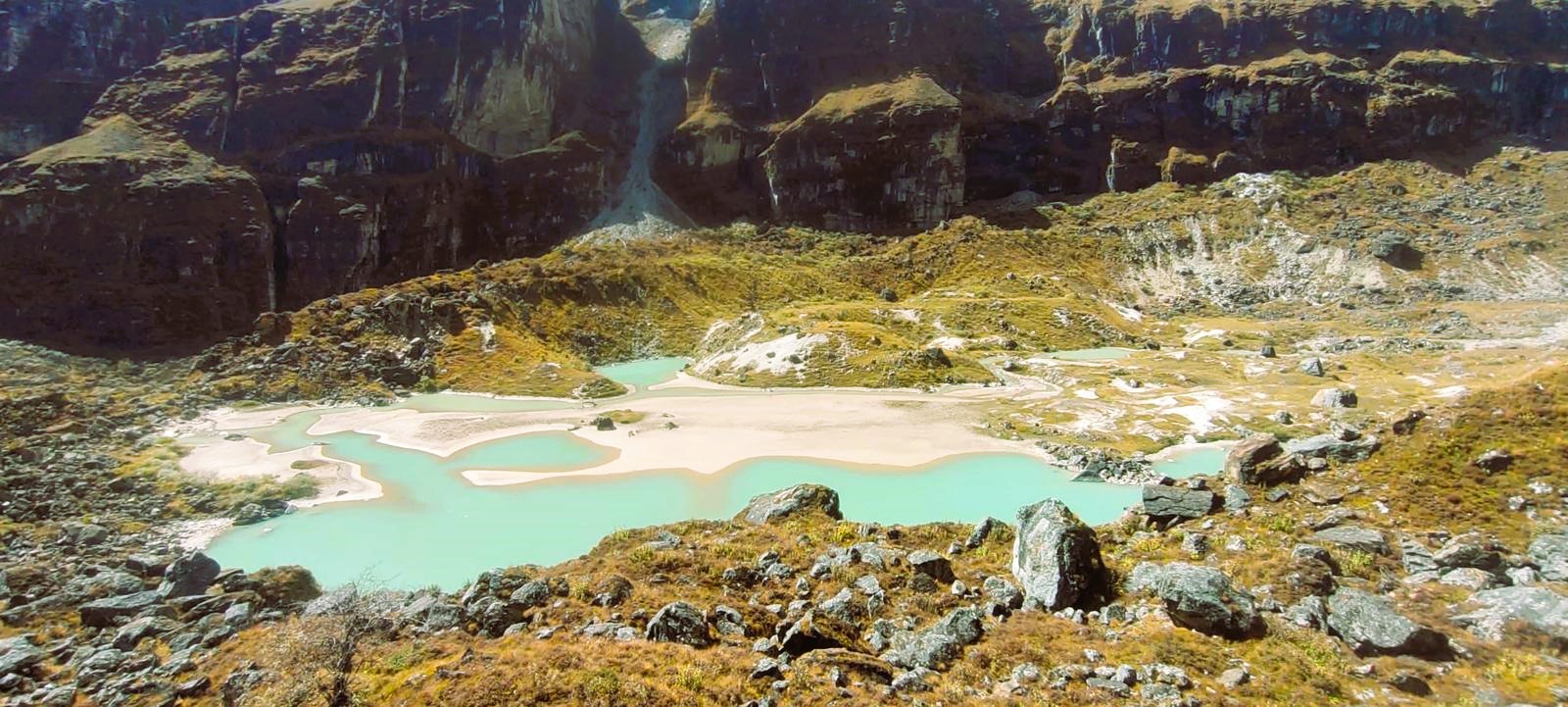
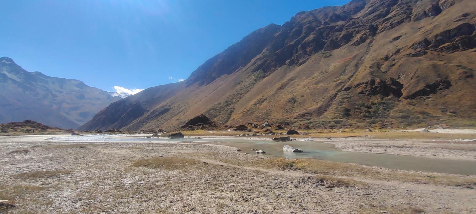
4,080 mIt can be challenging today as we cross the highest pass on this trek. The trail leads to a last settlement in the valley and drops to the Paro Chhu. Passing the lake of Tshophu (4,380m) you will climb up steeply to Bhonte La pass at 4,890 m, the highest point of this trek route. Reaching the Dhumzo Chhu river, you trek downstream passing the few houses of Soi Yaktsa (Dhumzo) to arrive at your camp soon after.
Accommodation
Tented CampMeals
Breakfast, Lunch, DinnerMaximum Altitude
3,800 mToday our trail climbs 100m over a ridge to drop to another stream then. After crossing the Takhung La pass (4,520m) you descent to Thombu Shong, three yak herder huts with your campsite next to them.
Accommodation
Tented CampMeals
Breakfast, Lunch, DinnerMaximum Altitude
4,180 mCrossing Thombu La pass (4,380m), trail makes a steep descent, zigzagging down the ridge through wildflower bushes, mostly edelweiss, before reaching Gunitsawa and finally Shana Zampa (2580m), where you will meet your transport and drive to Paro for about 2 hours.
Accommodation
Mandala ResortMeals
Breakfast, Lunch, DinnerMaximum Altitude
2,280 mAfter breakfast drive to the airport for your flight to onward destination with wonderful memories of Bhutan.
Tashi Delek !
Accommodation
Meals
BreakfastMaximum Altitude
2,280 mDate & Cost
Price: US$ 4,320 per person (Twin Sharing | Based on Minimum 4 Travelers)
Single Supplement:
Include
- Accommodation on a twin-sharing basis in hotels and sleeping tents (guests need to bring their own sleeping bags)
- All meals (including hot meals – breakfast, lunch, and dinner on trek)
- Daily SDF/Government Tax
- Bhutan Visa, Visa Processing
- Visa Fee, Government Tax & Surcharge
- Japanese/Korean-made transport
- Sightseeing as per the itinerary
- Route Permits/Special Permits
- Licensed & Certified English-Speaking Guide (including trekking guide on trek)
- All Hotel Tax and Service Charge
- Entry Fees to Museums and Monuments
- Toilet Tents and Individual Sleeping Mats
- Camp Fees
- Trekking Permits
- Kitchen Staff (Cook, Waiters, Dishwashers)
- Horses, Ponies & Porters
Exclude
- Flights
- Medical and Travel Insurance
- Drinks, laundry, tipping & other expense of personal nature
Gallery


Map
Frequently Asked Questions
The Jomolhari Base Camp is located at an altitude of approximately 4,080 meters (13,380 feet) above sea level. Some of the highest points along the trek reach around 4,700 meters (15,420 feet).
No, independent trekking is not allowed in Bhutan. All trekkers must go through a licensed Bhutanese tour operator who will arrange the necessary permits, guides, and logistical support for the trek.
Yes, all trekking groups on the Jomolhari Base Camp Trek are accompanied by a licensed guide, and a porter service is often provided to help carry your gear. This is a standard practice in Bhutan, ensuring the safety and comfort of trekkers.
Yes, as Bhutan is a protected area for tourism, you will need a special permit to trek in the region. The trek is typically organized through a licensed Bhutanese tour operator, who will handle all permits, including the necessary trekking and national park permits.
The Jomolhari Base Camp Trek is considered moderate to difficult due to its high altitudes and challenging terrain. Trekkers should be prepared for steep ascents, rough trails, and potentially high altitudes (up to 4,700 meters). It is recommended that participants have previous trekking experience and be in good physical condition.