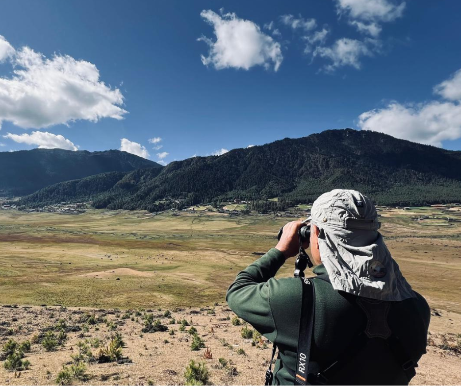
Forbidden Mustang, formerly the Kingdom of Lo, has lured intrepid travellers to its remote realm for centuries, but only the most adventurous made it to this mountainous and inaccessible bastion of Tibetan Buddhism. Tucked away along the upper Kali Gandaki River, the deepest river gorge in the world, it is a remote, ethnically Tibetan region of medieval villages, ancient cave hermitages, Tibetan Buddhist monasteries, arid, high desert, wild rock formations and soaring snow peaks. People have inhabited this harsh region for thousands of years, some of the early dwellers living or meditating in
Forbidden Mustang & Tilicho Lake
Highlight
- 'Old Tibet' & Medieval culture, colorful Mustang villages
- Fortresses, palaces, cave hermitages & gompas
- Incredible sculpted valleys & wild rock formations
- Classic scenery of the high Tibetan plateau in trans Himalayan Region of Nepal
- The Kali Gandaki gorge & explore fossil-rich riverbed
- A Visit the King's palace of LoGrandiose landscape
- 10 day permit
- Extension to Magical Tilicho Lake at 5,200 m over Thorong La Pass
Trip Facts
Start & End Point
Kathmandu/Kathmandu
Duration
24 D/23 N
Best Time
Spring, Autumn
Grade
Very Strenuous
Activity
Trekking
Accomodation
Hotel/Local Lodges
Meals
23 Breakfasts, 18 Lunches, 18 Dinners During the Trek
Max. Elevation
5,416 m
Itinerary
Welcome to Nepal! Upon arrival in Kathmandu a travel-to-nature Asia guide/representative will be at the airport to greet and take us to our hotel. Please look out for your name-card once you exit out of arrival area.

Accommodation
Manaslu Hotel
Meals

Maximum Altitude
Pashupatinath - Boudhanath – Bhaktapur
Weather permitting, we start our day with a scenic Everest mountain flight (optional) over the Himalaya to view Mt. Everest and many eastern ranges of Himalayas. Or begin our morning, visiting Hindu Pashupatinath (UNESCO Heritage site) and its sacred temple complex on the banks of the holy Bagmati river. Here, monkeys run up and down the steps of the burning ghats, and trident-bearing saddhus draped in burnt-orange and saffron sit serenely meditating - when they’re not posing for photos-for-rupees.
Next, the striking Buddha eyes of Boudhanath Stupa (UNESCO Heritage site) watch over a lively and colorful Tibetan community and attract pilgrims from all over the Himalayan Buddhist realm. In the midst of traditional gompas, and hung with long strings of multi-colored prayer flags, Boudhanath attracts Sherpas, Tibetans and tourists alike for daily circumambulations (koras) of the stupa.
For lunch we will drive to Bhaktapur city. Bhaktapur (UNESCO Heritage site) is a home of medieval art and architecture and it is like a living museum. As we walk along its cobblestone streets, notice the many ornately carved windows for which the town is famous. Over dinner we go over gear for trek & wildlife Safari and get to know your trekking guide. Overnight stay in Kathmandu.
Accommodation
Hotel Manaslu
Meals
Breakfast
Maximum Altitude
Transfer to domestic terminal and fly to Pokhara. During our half an hour flight the view of the mighty Himalayan range, including the Annapurna, Ganesh, Mt. Nilgiri, and Manasulu will be a life time experience. Upon arrival, our local representative will meet us and transfer to our hotel.
Pokhara, centre of the Western Development Region and traditional trading centre in the shadow of the Annapurna Massif. We have the afternoon to wander to the lake, do some shopping, or sit and relax in a café with a book. We'll head for Moondance Cafe or Boomarang restaurant for dinner and drinks in the evening, great spots.
Accommodation
Hotel Mount Kailash
Meals
Breakfast
Maximum Altitude
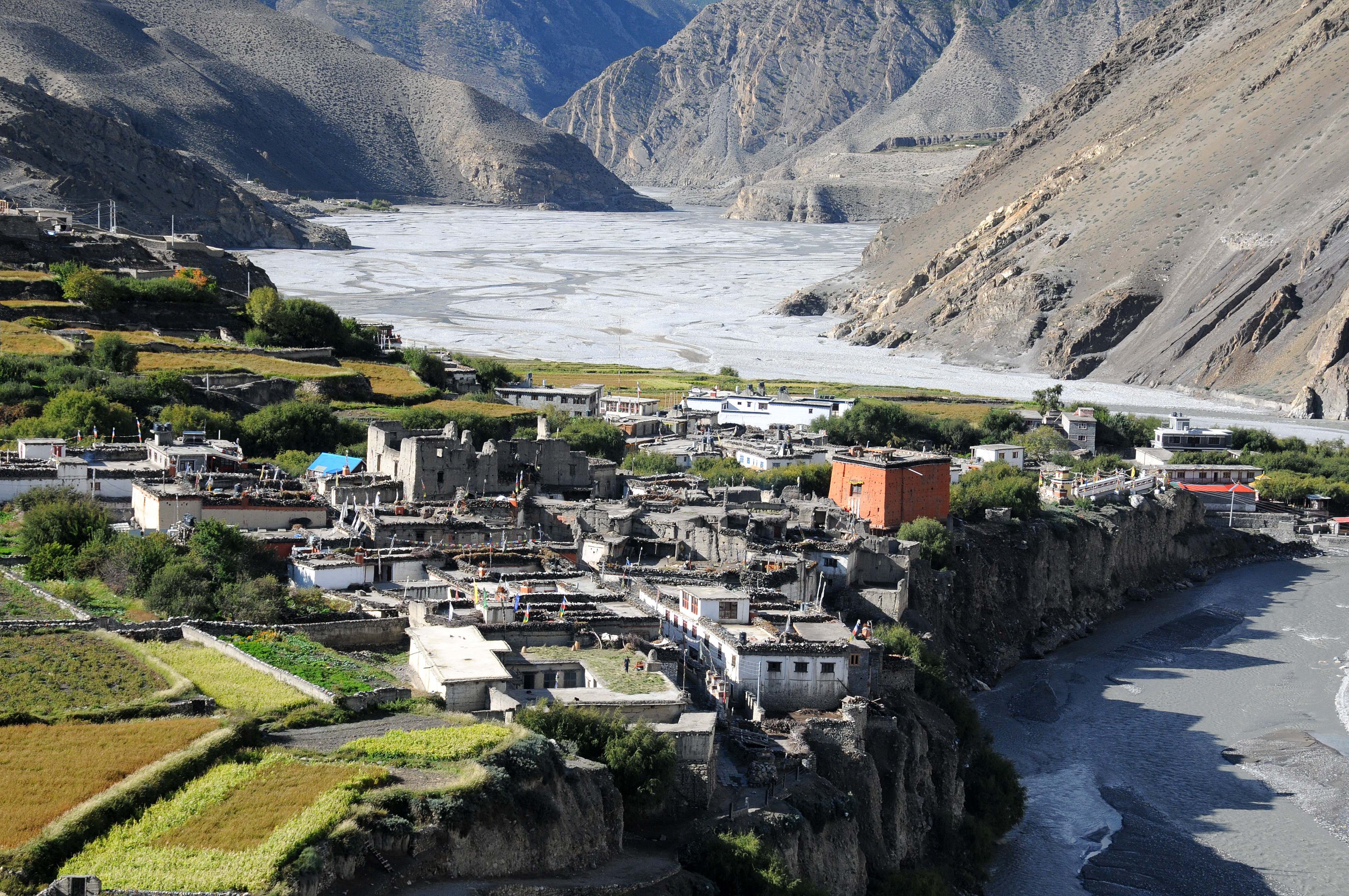
900 mUp early for our spectacular mountain flight to the district headquarters of Mustang, Jomsom. Once on the ground, at 2720 meters, we are greeted by the sound of jingling horse bells as the Mustangi people pass by with their pony caravans. After sorting out gear and loading our porters, we trek up the windy Kali Gandaki valley to Kagbeni. The wide trail along a sandy, saligram-filled riverbed provides views of the surrounding peaks of Dhaulagiri, Tukuche and Nilgiri, and to the south the entire Annapurna Massif. Kagbeni, spectacularly situated atop a cliff overlooking the confluence of the Kali Gandaki and the Jhong Khola rivers, is the last village in Lower Mustang and guards the entrance into Upper Mustang, visible across the Kali Gandaki riverbed. It is an oasis of green, patchwork fields in the midst of rocky, arid mountains. This ancient, partially ruined citadel town provides us with a taste of scenes to come in upper Mustang, with its narrow alleyways and tunnels, irrigation canals, green fields of barley and its massive, newly-restored brick-red gompa. At the police check post at the north end of the village where a sign reads 'Restricted area, tourists please do not go beyond this point', we will complete our paperwork to enter Upper Mustang tomorrow. We'll stay at the New Annapurnas Lodge or similar for the night, with time to explore the village in the afternoon. Overnight stay in Kagbeni.
Accommodation
Local Lodge/Guesthouse
Meals
Breakfast, Lunch, Dinner
Maximum Altitude
Jomsom (2,720 m) | Trek to Kagbeni (2,810 m|4.5 hrs)After breakfast, we enter the restricted area of Upper Mustang with our staff and horse caravan in tow. We head up a trail along the east bank of the Kali Gandaki, climbing over several ridges as we head north to the fortress-like village of Tangwe (3,100 m), a labyrinth of narrow alleys amongst white-washed houses, fields of buckwheat, barley, wheat and apple orchards. This village is unique in Mustang with its moat-like drainage system. Tangwe is split into two sections, the ruins of its ancient dzong (fortress) in the upper section. There is a salt mine two hours from Tangwe; the salt trade was of utmost importance to Mustang in years past. Nilgiri, which dominates the southern skyline at Kagbeni, continues to loom massively at the foot of the valley. Beyond Tangwe we reach Chhuksang (3,050 m) village and a naturally-formed tunnel through which the Kali Gandaki flows. The trek now leaves the Kali Gandaki valley and climbs steeply up a rocky gully to Chele (3,030 m), a village of extensive wheat and barley fields where we set up camp for the night. Overnight stay in Chele.
Accommodation
Local Lodge/Guesthouse
Meals
Breakfast, Lunch, Dinner
Maximum Altitude
2,920 mAfter a good breakfast, we hit the trail. The scenery is awesome, the classic high altitude desert of the Tibetan high plateau. Our trail ascends and descends as we trek past the river valleys leading into the Kali Gandaki River. We trek along the side of a spectacular, steep canyon to the Dzong La pass (3,550 m) marked by rock cairns. We then descend gradually to a group of chortens on a ridge, eventually arriving at the village of Samar (3,700 m), with its lovely poplar grove, formerly a staging post for Khampa raids into Tibet. The Annapurnas, although still dominated by Nilgiri, are visible far to the south. The route continues over a chorten-topped ridge and through the small village of Bhona, and then climbs sharply up to the Baga La, down to the few-house village of Yemdo, back up to the 4000 meter Yemdo Pass and back down to Syangmochen village for overnight.
Accommodation
Local Lodge/Guesthouse
Meals
Breakfast, Lunch, Dinner
Maximum Altitude
3,800 mRight after our breakfast we have 4,000 meter pass, the Syangmochen La, where the trail intersects awide east-west valley, before the final descent to the lovely village of Geling.
There is an impressive, red gompa in the village, and traditional Mustangi houses surrounded by barley fields to explore before heading furtehr to Ghemi.
From Geling, the trail climbs gently to a beautiful pass, the Nyi La (4050m), and descends to a bridge crossing the Tangmar Chu (river). From here, the trail looks across the valley to ochre, blue and steel-grey cliffs, and leads us past perhaps the longest and most spectacular mani (prayer) wall in Nepal. After crossing the minor Ghemi La (3,520 m) we arrive the village of Ghami (3,690 m) with a small gompa, and built along the steep edges of the cliff as many villages in Mustang are. Overnight stay in Ghami.
Accommodation
Local Lodge/Guesthouse
Meals
Breakfast, Lunch, Dinner
Maximum Altitude
3,510 mWe continue along the western route, stopping occasionally for passing herds of sheep and goats. Once past the village of Dhakmar, which is dominated by a dramatic, red canyon wall with many ancient cave dwellings, we cross the Mu-i La, drop back down and the climb yet again to high meadows by a meandering, rocky stream. Finally, Lo Ghekar, 'Pure Virtue of Joy'. in Ghar Gompa.
The gompa is reputed to be one of the oldest gompas in Nepal, and is connected by legend to Samye Gompa in Tibet, as well as to the ubiquitous Guru Rimpoche. The name means 'house gompa' in Nepali after the style of architecture, and it harbors many frescoes as well as wonderful carved and painted stones.
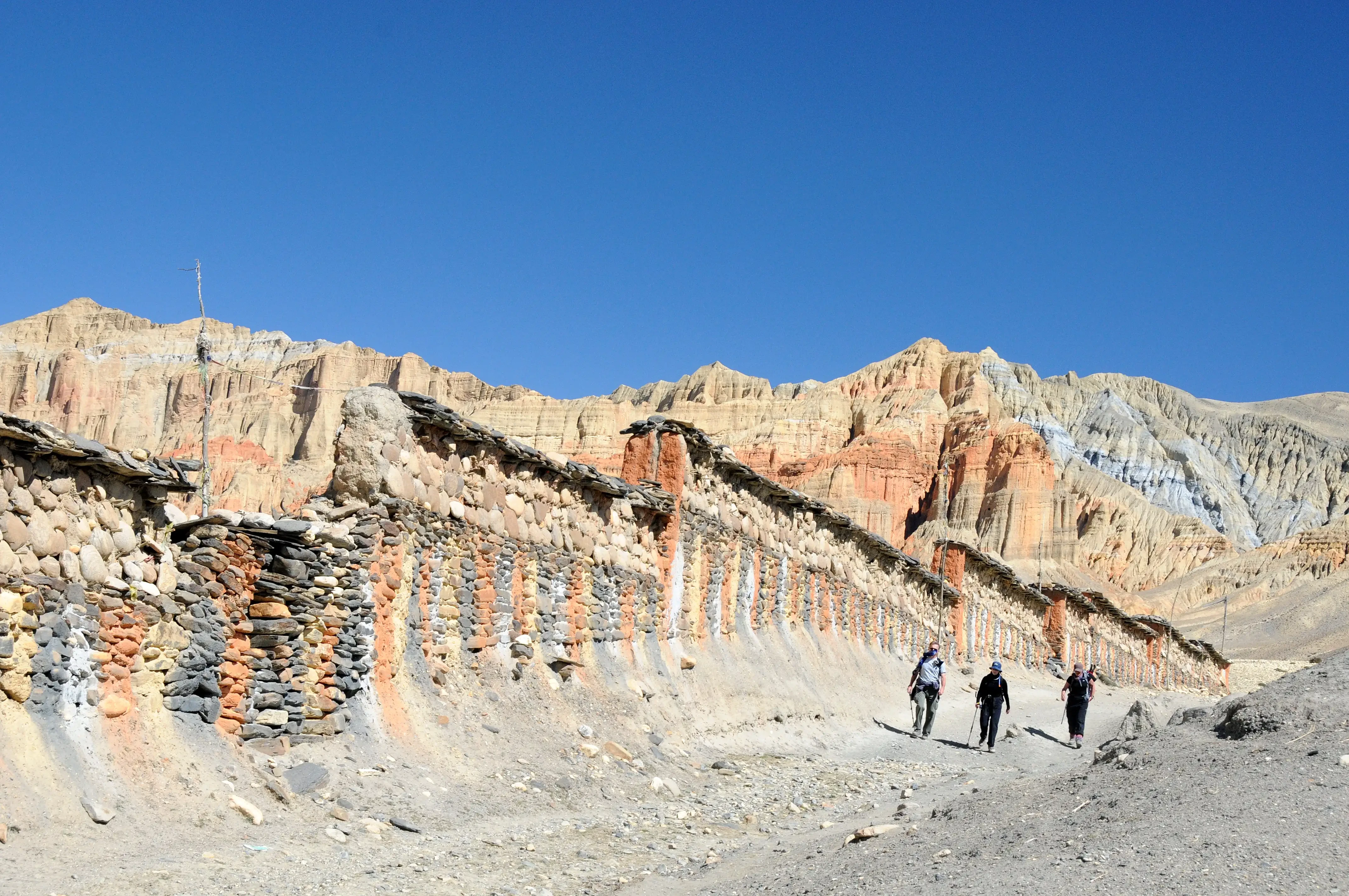
After lunch at Ghar Gompa, we head north towards Lo, descending a bit to cross a small, wooden bridge first. Ascending out of the canyon, the trail contours around two valleys, before passing the small village of Marang. Once atop the Marang La (4,353 m), we are treated to magnificent mountain views. We pass by Samduling Gompa and the ruins of several old houses, and after a short descent and an easy stream crossing, we climb back up to the plateau of Lo Monthang, aptly named the ‘Plain of Aspiration'. The fabled walled city of Lo, with a single entrance through which only the king is allowed to ride - all others must walk - is a wonderful sight! The late King Jigme Palbar Bista, called 'Lo Gyelbu' by the Mustangis, used resides at his four-storied palace inside the city walls. He was an avid horseman, and kept his own stable of horses, some of the best in Mustang. Those days, the king played a somewhat ceremonial role although he was well loved and respected throughout Mustang.
In the 1380’s, King Ame Pal established his reign in Lo, with the walled city of Lo Manthang as the capital and its inhabitants called Lobas. Within the walls of Lo Manthang are about 150 houses built among narrow streets, and some of the largest and finest Tibetan Buddhist gompas in Nepal. The city is quite prosperous due primarily to its past salt and wool trade along the Kali Gandaki with Tibet, and the Lobas themselves are still very Tibetan, living in Tibetan-style dwellings which we'll have a chance to visit. And perhaps, we we'll have a cup of the infamous solja (salt butter tea), or chang (barley beer) with our guide who also will know the best vantage points for sunsets and sunrises. Overnight stay in Lo Manthang
Accommodation
Local Lodge/Guesthouse
Meals
Breakfast, Lunch, Dinner
Maximum Altitude
Ghar Gumba (3,920 m) - Lo Manthang (3,840)Relax, sleep late and linger over coffee as we have a free day to explore within the ancient, exotic city walls of Lo Manthang. There are four major temples within the medieval walls of Lo, Jampa Lhakhang, Thubchen Gompa, Chodey Gompa and Choprang Gompa. There is also the Raja's Palace, home to the late King and Queen (who were from an aristocratic Lhasa family) and an interesting maze of a village to explore. And plenty of time to marvel at the surrounding panoramic views of the Tibetan Plateau and the Himalaya.
Accommodation
Local Lodge/Guesthouse
Meals
Breakfast, Lunch, Dinner
Maximum Altitude
Optional Experience
Chosar Valley
We will visit one of the two regions, two valleys to the northeast and northwest of Lo Manthang or Tingkhar, Namgyal & Nyamdok since we have only 12-day restricted permit; horses are available for the day for a small fee for those in...
Sadly, we must leave magical Lo, but new adventures await us on our route south. We will attempt to trek to Dhi (Dri) along the eastern, winter route, following the trail along the western side of the Mustang Khola to Dhi. If this route to Dhi isn't possible because of weather or trail conditions, we will trek over the Lo La (3950m) to Tsarang and head east to Dhi from there.
Following is the main route to Tsarang; leaving Lo Manthang, we trek down the east side of the valley. The trail descends steeply from the cairn on a ridge at 3,850 m called Lo (Dry) La, passes an impressive chorten high up on another ridge, and crosses the Charang Chu. We then head back up the trail to Tsarang, perched on the edge of a beautiful canyon, with magnificent views of the villages of the distant hillsides. The huge five-story white dzong and ochre-hued gompa contain a fascinating array of statues, thankas and large Buddha paintings.
Elaborate sand mandalas are created here at festival time, and then ceremonially deposited into the river at the festival’s end. From here, we will continue to Dhi village, one of the best villages of whole Lo Manthang and it seems more prosperous and settled in a very suitable place. We then cross a river to follow a path along the left bank of a river side to Yara village at (3,650 m). Overnight stay in Yara.
Accommodation
Local Lodge/Guesthouse
Meals
Breakfast, Lunch, Dinner
Maximum Altitude
3,650 mAn exploratory day-trip out to the village of Yara, and further on to famous Luri Gompa. The sgo-nyer, or key-keeper of Luri Gompa is reputed to live in Yara, so we will stop en route to look for him. There is a newly discovered group of six cave dwellings nearby, called Tashi Kumbum, with incredible ancient murals and chortens which perhaps the key-keeper can show us. However, Gary McCue (trekking guide/author), who went there over fifteen years ago, wrote that the approach is very difficult/dangerous although though only an hour from Yara. We'll have to ask if there have been improvements in the formerly crumbling trail.
The Luri caves are filled with wonderful, 'Newari-style' (Gary McCue) Buddhist frescos and old chortens; historians estimate them to be from the 13th or 14th century, and linked to the Tashi Kumbum caves, one of a group of connected cave dwellings throughout this particular region. Unfortunately, or fortunately, most have been rendered inaccessible due to the intense erosion in Mustang, so will remain hidden throughout history. Overnight stay in Yara.
Accommodation
Local Lodge/Guesthouse
Meals
Breakfast, Lunch, Dinner
Maximum Altitude
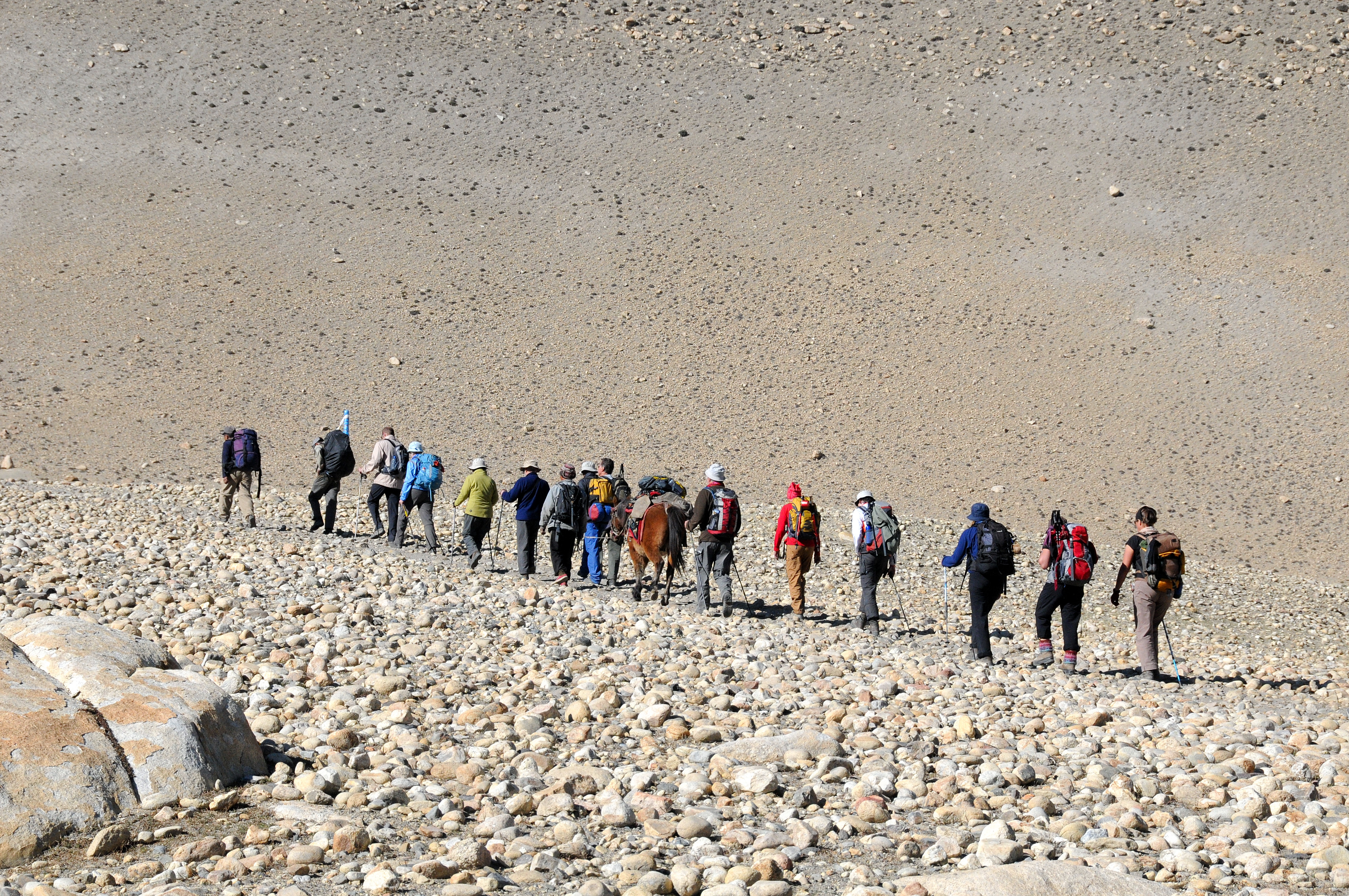
4,000 mFrom Yara, the trail goes through the river for around 2 hours and crosses a river from Damodar Kunda, one of the sacred lakes. There is no bridge on the river so you need to walk across in bare feet to cross this river.
After crossing the river the trail climbs high above a pass of 3,850 m. The trail goes through a grassless, treeless bare hill. After the pass, the trail again drops directly to Tangbe village at an elevation of 3,370 m. Tange is a small village of around 30 houses but most of the houses are attached to each other. On the rooftops, one can see piles of dry woods, which also reflects the prosperity in their society. Overnight stay in Tange.
*** Note: depending on weather, trail conditions and the stamina of the group, we could try the remote eastern route to Tetang via Tangye, but this would require at least one long, strenuous day. But the rewards would be incredible, with a broad panorama stretching from Tsarang to Lo Manthang to the Tibetan border, and continuing with views of Dhaulagiri and other 8,000 meter peaks. Open to discussion.
Accommodation
Local Lodge/Guesthouse
Meals
Breakfast, Lunch, Dinner
Maximum Altitude
3,370 mThe trail walks through a steep ridge of hills providing some fine views of the wind carved hills. Tetang village is formed between 2 hills; they must have found it a safe place to avoid the strong wind that hits the entire Kali Gandaki valley. Tetang is the upper village of Chhusang, which we visit on the first day entering to Mustang from Kagbeni. It will take around 9 hours to reach Chhusang. Overnight stay in Chhusang.
Accommodation
Local Lodge/Guesthouse
Meals
Breakfast, Lunch, Dinner
Maximum Altitude
3,022 mAnother exploratory day as we continue south over the Gnyu La (4,200 meters), which boasts a panoramic view of Annapurna, Dhaulagiri and the Tukuche range. A trail from the east intersects our trail just below the pass; soon after passing this trail we veer east towards Muktinath and the balmy villages of Lower Mustang via Chhengar village, with a small but active red gompa, and continues past a nunnery to join the main trail from Manang.
We finish the trek at the serene temple complex of Muktinath, where we stay in a guest house just five minutes down the trail from Muktinath at Ranipauwa for two nights. Overnight stay in Muktinath.
Accommodation
Local Lodge/Guesthouse
Meals
Breakfast, Lunch, Dinner
Maximum Altitude
3,800 mMuktinath is an important pilgrimage site for Buddhists and Hindus situated in a tranquil grove of trees, and contains a wall of 108 waterspouts in the shape of cows heads spouting sacred water, the Jwala Mai temple with a perpetual spouting flame and the pagoda-styled Vishnu Mandir, all of which make up the auspicious combination of earth, fire and water.
From Muktinath, we have outstanding views of the colorful valley and neighboring villages, patchwork after patchwork of barley and potato fields, and walled enclosures of apple orchards. We may head half an hour down the mail trail to explore Jharkot village, a bit less touristy and return back to Muktinath (optional).
Cold beers available; or try some Marpha apple brandy, the best in the region, and certainly the strongest brew around! Overnight stay in Muktinath.
(It is the longest day on the Annapurna Circuit, trekking from Muktinath to Throng La Phedi via Thorong La Pass. This takes over 8-9 hours and a distance of 15 kilometers. It is a steep climb and descent resulting in one of the most physically challenging on this trip.)
Accommodation
Local Lodge/Guesthouse
Meals
Breakfast, Lunch, Dinner
Maximum Altitude
We start very early in the morning in order to cross the Thorong La pass and arrive Thorong La Phedi on time and before it gets dark. The trail from Muktinath ascent gently for about couple of hours to Muktinath Phedi at Charabu at 4,200 m with only few lodges open in the high season.
This is where people hiking the Annapurna Circuit from Muktinath to High Camp will stay one night to help acclimatize at 4,200 meters. The mountain landscape is breathtaking and trail is relatively harmless. Due to the high altitude we will slow our space moving up. As we climb up for the last 100 m to the pass we will take in-between short rest and in about 5-6 hours we should be on the top of Throng La pass at 5,416 m. At the pass there is a small teashop which usually serves tea, noodle soup and dal baht is usually boarded up. The surrounding with Himalayan Panorama is just breath taking. Even though this is the highest trekking pass in the world and the highlight of the Annapurna Circuit, the journey to get here is second to none.
We take some obligatory photos to celebrate our success. The land around us is barren, just hundred of rocks making up the ground. After a short break with some Nepali Tea & Noodle Soup or even Dal Bhat, we descent slowly down the mountain.
It is a difficult descent as you try to avoid slipping on the loose rocks. In about two hours we should arrive High Camp. If time permits and if we are not too exhausted we continue all the way down to the Throng La Phedi for overnight at the guesthouse, otherwise we stay in High Camp.
Accommodation
Local Lodge/Guesthouse
Meals
Breakfast, Lunch, Dinner
Maximum Altitude
4,450 m to 5,416 mWe take our time this morning. After our leisurely breakfast we hike down to Tilicho Shree Kharka for overnight stay.
Accommodation
Local Lodge/Guesthouse
Meals
Breakfast, Lunch, Dinner
Maximum Altitude
4060 mToday we hike up to Tilicho Lake Base Camp. The Mountain Panorama is just stunning with upfront view of Annapurna IV (7,525 m), and Gangapurna (7,454 m) as we head towards the lake.
With through a series of zigzags trail to the downhill brings us to one point is an intersection. One path maintains the elevation, traversing the slopes towards a place where the valley is narrow; the other continues to ascend towards the line of the ridge.
The former is the old trail and is much more difficult as it goes on really vertical screed; the latter is the new path that goes a completely different way. We continue along the new trail, reach a high peak, and descend on switchbacks carved out through the screed slopes to a side valley of the main valley. At its bottom is a brook. On the other side of it is a building known as the Tilicho Base Camp at an elevation of 4,200m. Trail to Tilicho base camp would get very interesting if things get icy. There is a lodge at Tilicho base but opened only in the season and we are not sure if it's open when we are there. In many ways it is more outstanding than crossing Thorong La. Hertzog's grand barrier (Annapurna nortehr barrieir) is in your face the entire time and closes views of Tilicho Mountain from the camp. We will camp here for couple of nights.
Mountains: 1) Annapurna I, 2) Tilicho peak, 3) Khangsar Kang or Roc Noir, 4) Gangapurna, 5) Annapurna III, 6) Khatung Kang, 7) Yakawa Kang
Accommodation
Camping
Meals
Breakfast, Lunch, Dinner
Maximum Altitude
4,200 mToday, we will climb up for Tilicho Lake (4,949 m).
The trail takes us through icy moraine offering the perspectives of Mt. Nilgiri, Tilicho, Muktinath, and Khangsar Peaks. When you reach near the lake, you will take nothing in excess of a couple of more minutes to scoff up the perspective on such admirable lake. Since more often than not the lake stays frozen, it is as well named the ‘Frozen Lake’. We spend some time at the lake side to enjoy and may click lots of pictures with the view around us.
We will return back to the Tilicho Base Camp full with the memories at the Tilicho Lake. Depending up on the weather pattern and personal physical condition, we may continue trekking up to Mesokanta base camp for Overnight.
Accommodation
Camping
Meals
Breakfast, Lunch, Dinner
Maximum Altitude
We will start our return journey with lots of memories with us. Today is little bit tough day of this adventure, starting early morning to cross two high passes, heading up the high slope traversing high Tilicho pass then with short descend to the base of Mesokanta La pass, with short rest then climb the last pass of this adventure over Mesokanta-la at 5,099 meters. Parts of the way are very steep with loose rocks and gravel! On the top festooned with Buddhist prayer flags, here with mind-blowing scenery of surrounding high peaks.
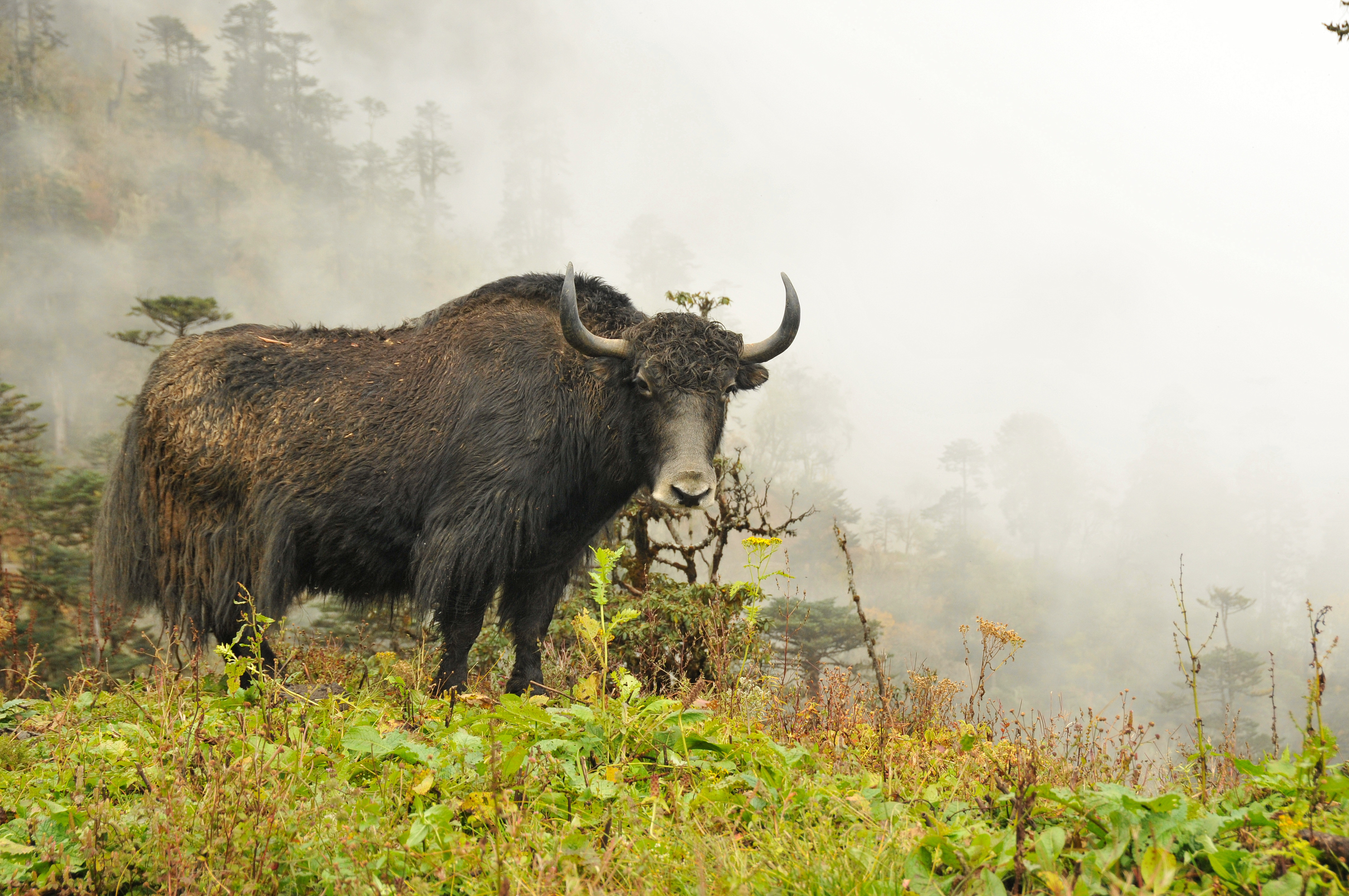
The trail continues to climb out of the Marsyangdi Valley. The the vegetation now consists of scrub juniper and alpine grasses. This will lead us around and down to cross the river on an old log bridge between Gunsang and Yak Kharka. It’s fun to see large yaks grazing at Yak Kharka. The view of Annapurna III is excellent. We will stay overnight in Yak Kharka. The sunset here can be one of the most stunning!
Accommodation
Camping
Meals
Breakfast, Lunch, Dinner
Maximum Altitude
5,099 mA lovely, gentle walk back down to Jomsom. After our last breakfast up in the mountain we will start the journey towards Jomsom and today is the last day of our trek on these magnificent mountains, we will move through the trail of Kagbeni or Lupra to arrive in Jomsom along a long, cobbled trail in time for lunch, with the afternoon free to wander and shop.
We’ll celebrate our trek through ‘forbidden’ Mustang with a few cold beers at the lodge in the evening. Overnight stay in Jomsom.
Accommodation
Local Lodge/Guest House
Meals
Breakfast, Lunch, Dinner
Maximum Altitude
We board an early morning flight from Jomsom to Pokhara and connect flight to Kathmandu. Overnight stay in Kathmandu.
Accommodation
Hotel Manaslu
Meals
Breakfast
Maximum Altitude
Today is at leisure to give your body some much needed rest after a long and strenuous trekking. Just relax or go for last minute shopping in Thamel.
Accommodation
Hotel Manaslu
Meals
Breakfast
Maximum Altitude
Transfer to the airport for your homeward-bound flight.
Accommodation
Meals
Breakfast
Maximum Altitude
Date & Cost
Price: US$ 3,435 per person
Internal Flight Extra: US$ 530 per person (subject to change without notice)
Single Supplement: US$ 335
Include
- Arrival & departure airport transfers
- Accommodation on twin sharing basis with daily breakfast
- Guided city tour in Kathmandu valley by private tourist vehicle, including entry fees to all monuments
- All standard meals (Breakfasts, Lunches and Dinners) during the trek
- Guesthouse accommodation during the trek in mostly twin-share and occasionally dormitory-style rooms.
- 3 nights camping service including meals, porters and service crew during the trek around Tilicho Lake from Mukthinath to Jomoson.
- Experienced English speaking trekking guide
- The required number of local staff, porters and mules to carry your luggage/camping equipments/gear during the trek - one porter for every two participants.
- Food, accommodation, salary, insurance, equipment and medicine for all staff
- Special Upper Mustang Permit US$ 500 per person for the first 10 days
- Annapurna conservation permit (ACAP) and all necessary permits
- Airfare for Kathmandu- Pokhara – Jomsom – Pokhara - Kathmandu including airport departure tax
- Domestic airfare for your guide who will escort you throughout the trip
Exclude
- International flights
- Visa fee
- Travel insurance
- Meals not mentioned in the itinerary
- Personal clothing & equipment
- Tips for tour leader/guide, driver, hotel staff and porters
- Items of personal nature such as alcoholic beverages, soft drinks, laundry, showers and other unforeseen expenses
- Any item/service not mentioned under "included"
Accomodation
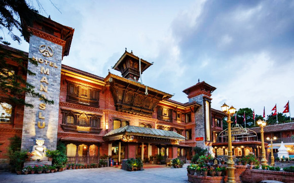
Hotel Manaslu, Kathmandu
Hotel Manaslu located in the immaculate area of Lazimpat, Kathmandu is a heritage hotel established in 1972. We have kept the proud heritage of Nepal alive throughout its operation by offering unparalleled service and warm hospitality, that defines the values and culture of Nepal. The architecture of our hotel includes many ancient pieces that have been carefully restored and incorporated.
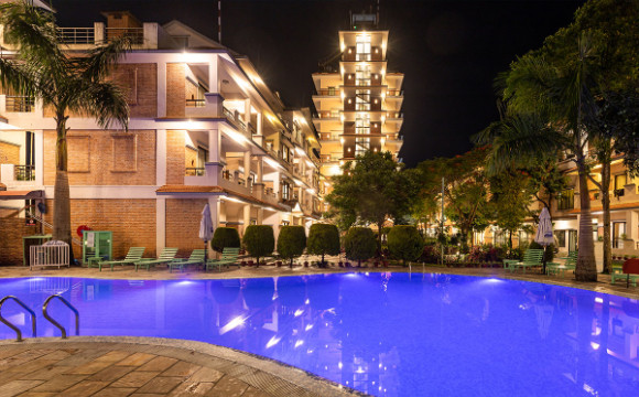
Mount Kailash Resort, Pokhara
Whether you are in Pokhara for business or pleasure, this modern social venue attracts not only hotel guests but also local shoppers, business people, and clubbers. With 51 beautiful rooms meeting with all the modern amenities, two dining spaces along with terrace dining experience, a beautiful garden, and spa. Our bar is a great place to chill out.
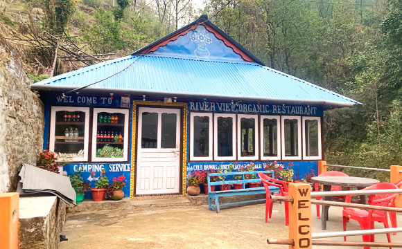
Lodge/Guesthouse, Nepal
Lodges/guesthouses in the trekking routes of Nepal range from simple buildings made out of stone, mud, and wood, to modern-looking concrete ones depending upon their geographic locations. Bedrooms generally have two single beds (and a table) or several beds in case of a dormitory. Usually, the kitchen and dining are combined into one common room (area).
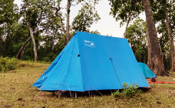
Camping Tent
Our classic A-frame or ridge tents are sturdy and have plenty of room for two people. We use water and windproof flysheet which help make the tent nice and cozy inside. To complete the setup we provide a high-quality form mattress together with an insulation pad so that you get a good sleep after a long tiring day.
Gallery