Legend has it that the omnipresent Guru Rinpoche, who spread Tibetan Buddhism throughout the Himalaya, discovered this hidden land, a “beyul” or refuge or shangri-la, over 1700 years ago, and it has been inhabited by Tibetan yak and sheep herders, called drokpas, for over a thousand years. Now a part of Nepali district of Dolpa, but historically was part of the Zhangzhung Bon-po Kingdom which dominated Western Tibet for over a thousand years, later defeated by the first Tibetan dynasty, Yarlung, between the sixth and eighth centuries.
Upper Dolpo trek is an evocative journ
Upper Dolpo Magic Trek
Highlight
- Timeless and quaint Dolpo villages
- Tibetan Buddhist gompas (monasteries)
- Shey Gompa and Crystal Mountain
- Unique route around Crystal Mountain
- Stunning turquoise Phoksundo Lake
- Rarely visited Bhijer route
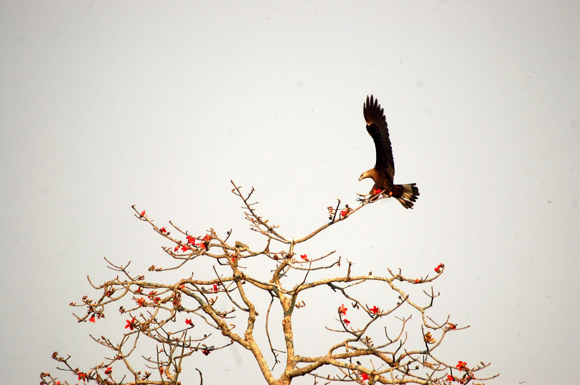
- Exotic wildlife and impressive display of wild flower
- Visit cultural places at Shey Gompa, Sangdang, Chharka.
- Breathtaking mountain panoramas and arid rolling hills
- Peaceful, scenic wilderness camps
Trip Facts
Start & End Point
Kathmandu/Kathmandu
Duration
27 Days/26 Nights
Best Time
Spring/Autumn
Grade
Very Strenuous
Activity
Trekking, Culture
Accomodation
Hotel/Local Lodges
Meals
26 Breakfasts, 20 Lunches, 20 Dinners
Max. Elevation
5,375 m
Itinerary
Welcome to Nepal! Upon arrival in Kathmandu a travel-to-nature Asia guide/representative will be at the airport to greet and take us to our hotel. Please look out for your name-card once you exit out of arrival area.
If you’re not feeling jet-lagged, take some time to explore Kathmandu’s medieval backstreets, discover temples dating back to the 16th century, make your way down to Thamel, the main tourist hub in Kathmandu and a great place to dine. There are myriads of options to choose from like New Orleans Cafe, Rum Doodle, Bear Garden etc just to name a few. Enjoy your evening and get some rest as the adventure begins tomorrow!

Accommodation
Manaslu Hotel
Meals

Maximum Altitude
1,370 mPashupatinath – Boudhanath – Bhaktapur
Weather permitting, we start our day with a scenic Everest Mountain flight (optional) over the Himalaya to view Mt. Everest and many eastern ranges of Himalayas. Or begin our morning, visiting Hindu Pashupatinath (UNESCO Heritage site) and its sacred temple complex on the banks of the holy Bagmati river. Here, monkeys run up and down the steps of the burning ghats, and trident-bearing saddhus draped in burnt-orange and saffron sit serenely meditating – when they’re not posing for photos-for-rupees.
Next, the striking Buddha eyes of Boudhanath Stupa (UNESCO Heritage site) watch over a lively and colorful Tibetan community and attract pilgrims from all over the Himalayan Buddhist realm. In the midst of traditional gompas, and hung with long strings of multi-colored prayer flags, Boudhanath attracts Sherpas, Tibetans and tourists alike for daily circumambulations (koras) of the stupa.
For lunch we will drive to Bhaktapur city. Bhaktapur (UNESCO Heritage site) is a home of medieval art and architecture and it is like a living museum. As we walk along its cobblestone streets, notice the many ornately carved windows for which the town is famous. Over dinner we go over gear for trek & wildlife Safari and get to know your trekking guide. Overnight stay in Kathmandu.
Accommodation
Manaslu Hotel
Meals
Breakfast
Maximum Altitude
Transfer to the domestic airport for about an hour scenic flight to Nepalgung. At Nepalgunj we will have time in the late afternoon or evening to have a look around the town which is situated on the southern Nepal border with India. Usually weather of Nepalgunj is hot and humid. Overnight stay in Nepalgunj.
Accommodation
Siddhartha Hotel
Meals
Breakfast
Maximum Altitude
Transfer to the airport for an early morning flight to Juphal. Dolpo flights are always early in the morning. This is because high winds in the Thulo Bheri Valley begin around 10 am, making later flights impossible. Once we have gotten all our equipment of the Twin otter in Juphal (2,500 m), we start out on the short walk from Juphal to Sulighad to avoid the bustle of Dunai and instead we stay at a peaceful, relatively new campsite that is a couple of hours walk from the airstrip.
Accommodation
Camping Tent
Meals
Breakfast, Lunch, Dinner
Maximum Altitude
2,500 mWe will follow the route of the confluence of the Thuri Bheri and Sulighat rivers and turn to the north and follow the Sulighat River. The trail is fairly undulating and we are never far away from the river and its roar. We also walk through some nice villages such as Parela meaning eyelash, Rahagaon meaning eyebrow, and Ankhe meaning eye.
Accommodation
Camping Tent
Meals
Breakfast, Lunch, Dinner
Maximum Altitude
2,838mThe path goes entirely through the forest to reach at Renji. This is a very small village and consists of just a couple of houses and a primary school.
Accommodation
Camping Tent
Meals
Breakfast, Lunch, Dinner
Maximum Altitude
This day about 2 hours walking you will reach at Amchi Hospital. The walk goes almost entirely through beautiful pine forests, with some bushes, birches and other broadleaf trees in it as well. Before reach to Ringmo on the way you will see a spectacular waterfall of 167 meters high. After views point the path is going down for about half an hour until it gets close to the river again then walking through the forests, till you reach Ringmo. Ringmo is a charming village. People practice the Bonpo religion here. Bonpo is a lot older than Buddhism and goes thousands of years back. It has more animistic aspects than Buddhism. For outsiders it is difficult to see the difference between Bonpo and Buddhism, but one important aspect is that you have to cross their Mani walls and chortens anti-clockwise, while according to Buddhist custom, you pass them clockwise. The women wear dark or checked dresses with colorful aprons made from yak wool. You see fewer men in the typical dress, which is a long coat, from which they let one sleeve hanging down. Strolling around the village, you might see women weaving. In Ringmo women make very nice woven products, like belts, bags, shawls and blankets. Most items are made from cotton, but they also sell products made from yak wool. There are a few shops where you can buy this item.
Accommodation
Camping Tent
Meals
Breakfast, Lunch, Dinner
Maximum Altitude
Your body needs time to acclimatize to the higher altitude. The Phoksundo Lake is such a beautiful place for a free day. There is a beautiful Bonpo Gompa (Monastery) at the shore of the lake, which is worth a visit. It’s a 20 minute walk to the monastery through the pine forest. In the monastery you can observe a statue of Thönpa Chenrab, the founder of Bonpo religion, a Buddha who lived thousands of years ago.
Accommodation
Camping Tent
Meals
Breakfast, Lunch, Dinner
Maximum Altitude
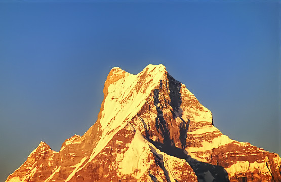
This day you enter the restricted area of Upper Dolpo. You follow the famous Demons Trail from the movie Caravan of Eric Valli, a beautiful movie about the life of people in Dolpa who bring their yaks over difficult passes bearing salt from Tibet to trade with grain from the lowlands. In the movie, this trail is used during this salt caravan and one of the yaks falls in the lake here. It’s a spectacular trail, going high above the Lake. At some parts it gets very narrow due to landslides. The trail climbs to a ridge, from which you have a spectacular view on the Lake, Ringmo, the dark green pine forests and the snowcapped mountain Norbung Kang (6,085 m) to the south. It’s now a gradual descend to the lake northern shore, which is a good place for lunch. After this the trail climbs through a wide valley, crossing some streams. You have a splendid and nearby view to the flanks and tops of the snowcapped Kanjirowa Himal (6,612 m).You arrive at an alpine area which is a good place to camp.
Accommodation
Camping Tent
Meals
Breakfast, Lunch, Dinner
Maximum Altitude
The Phoksundo Valley gets quite narrow, with high rock walls on both sides. You have to cross a couple of streams. After about half an hour, you leave the main valley and enter a narrow gorge. It’s a long, pretty steep climb through the steep sided valley. The campsite is at Snowfields Camp, a name given by Peter Mathiesson in his famous book the Snow leopard. From here strenuous climb of about 2½ hours over a dusty path to Kang-La (5,350 m), locally also called Ngadra-La. There is snow most of the times, which makes a bit difficult for descending.
Accommodation
Camping Tent
Meals
Breakfast, Lunch, Dinner
Maximum Altitude
From here descend is pretty steep the first 45 minutes, but after this, it is going gradually for about 3 hours, till you reach Shey Gompa. Getting nearer, you pass red and white chortens and Mani walls. Shey Gompa is a very small village, with a couple of houses, and of course the Gompa. The 11th century Gompa is located beneath the Crystal Peak on a small grassy plain, at the confluence of two rivers. It is said to be constructed by a Tibetan Buddhist, who arrived here on the back of a flying snow lion. It’s a magical place, and Shey Gompa is often called the spiritual heart of Dolpa. Every year hundreds of pilgrims come to visit the Gompa and to make a Kora (Clockwise Circuit) of the Crystal Peak. People living here are direct descendants of Tibetans, which you can notice easily by their faces and their dress. They women wear dark dresses with colorful aprons made from yak wool. Men wear a long coat, from which they let one sleeve hanging down.
Accommodation
Camping Tent
Meals
Breakfast, Lunch, Dinner
Maximum Altitude
During the day, we can go to Tsakang Gompa (4,575 m), a monastery from the Buddhist Kagyupa sect. This gompa appears in the movie Himalaya. It is spectacularly located high on a red rocky slope. The trail to Tsakang Gompa partly follows partly the same trail as pilgrims follow to make a kora of the Crystal Peak. We will probably see flocks of blue sheep in these areas. Many blue sheep live here, as the abbot of Shey Gompa imposed a ban on hunting them. Besides, in these regions you have the best chance of seeing the snow leopard.
Accommodation
Camping Tent
Meals
Breakfast, Lunch, Dinner
Maximum Altitude
4,575 mAnother pass to cross this day, the Sele-La, also called Gelu-La, of 5,000 m. The climb to the pass goes through a narrow valley. From the pass we have a good view to the north of the arid Tibetan Plateau, which is stretching out seemingly endlessly before you. To the east you can see Mustang. After the pass, it’s a long descend to the pastures of Namgung. Scattered in the landscape, we will see some fields. Many times accompanied with a big Tibetan tent, as the fields are too far from the village to go there and go back each day. The people in Namgung are very friendly and open.
Accommodation
Camping Tent
Meals
Breakfast, Lunch, Dinner
Maximum Altitude
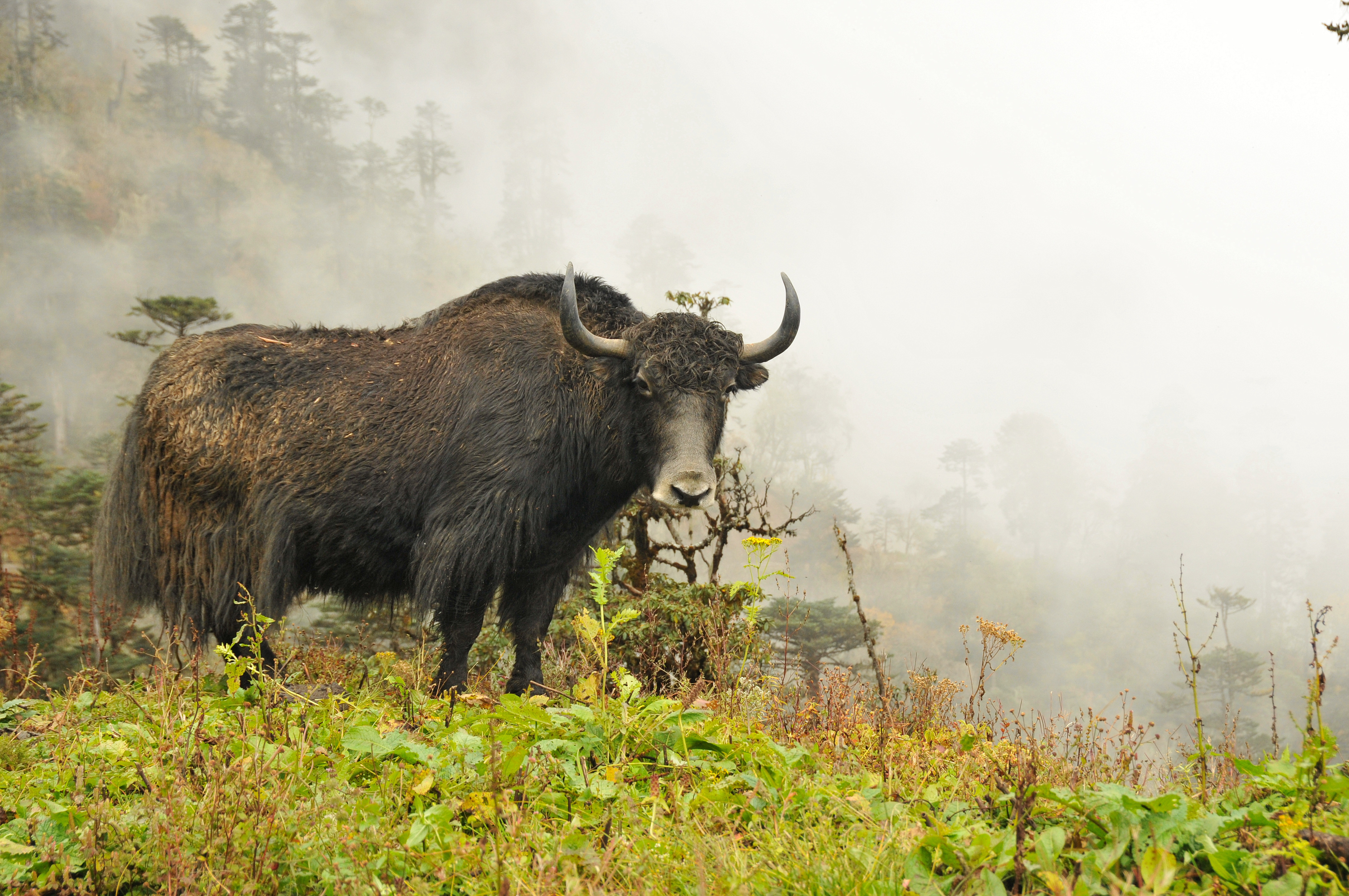
5,010 mThe path goes high above the Namgung River and then descends steeply to the village of Saldang. Saldang is the largest settlement of inner-Dolpo. It’s a spread out, traditional agricultural village, surrounded by fields. Barley, buckwheat and potatoes are among the few crops that can grow in this barren landscape. Besides, people live from what the yak gives them and from trade. Saldang is close to the Tibetan border and some of the salt trade caravans pass through Saldang. The trading of salt for grain and rice is a century old tradition that still prevails in Inner-Dolpo. The people from Saldang are semi-nomadic. In the warm months they trek in the highlands with their herds of yaks and sheep. The ones who are better off let the pure nomadic people of Dolpa.
Accommodation
Camping Tent
Meals
Breakfast, Lunch, Dinner
Maximum Altitude
The trail follows the Nang Chu river most of the way on this wild barren windswept terrain. Walk begins along the fairly gradual path with few ups and downs slope and then passing through the small settlement of Tiling and Lurigaon till we reach to Yangier Gompa (3,750 m) and visit very old Bon-Po Monastery. We then continue walk to Nisalgaon where our camp set.
Accommodation
Camping Tent
Meals
Breakfast, Lunch, Dinner
Maximum Altitude
We continue up the valley to Mugaon and climb towards the Mushi La at (5,030 m). Then we descend towards Shimen village, we end the day at a good campsite in pastures above the village at 4,010 m.
Accommodation
Camping Tent
Meals
Breakfast, Lunch, Dinner
Maximum Altitude
5,030 mHeading south along the Panjyan Khola, staying on the eastern bank, we pass two trails leading north to the border of Tibet on our left, and further along Pu Gompa in the hills to the right. Namyal Gompa is another hour away also to the south of the trail, a larger Gompa. From Targaon and Phalwa, another trail branches off to the north heading to the Tibetan border, signifying how important trade with Tibet is still to the Dolpo. Thinje, just past this intersection and before another, is a large, prominent village from where many of the villagers acting in the movie 'Himalaya' come. Tenzin Norbu, the famous 'Ngagpa' painter of Dolpo, also comes from the Panzang region. In the old times, his ancestors, also monk painters, traveled to Lo Manthang in Mustang to pay their tribute in murals, Thankas and Mani walls. We've been told it's an amazing village, so we've scheduled a 'rest' or exploration day to take advantage of this.
Accommodation
Camping Tent
Meals
Breakfast, Lunch, Dinner
Maximum Altitude
We trek past the runway of mysterious Tinje to a trail junction at (4,130 m), where a high route leads to Tarap. We continue southward to a campsite on the banks of the river at Rakpa (4,530 m).
Accommodation
Camping Tent
Meals
Breakfast, Lunch, Dinner
Maximum Altitude
We begin our day with a long climb to the Chharka-La (4,920 m). We continue on the trail descending along the side of the valley, then make a big drop into a side valley at 4290 m. We then make a long traverse down to the picturesque village of Chharka on the banks of Barbung Kola at (4,120 m). Chharka is a small hamlet of closely-built, white-washed dwellings, medieval in feel, with a Bon-po monastery, Sarchhen Gompa.
Accommodation
Camping Tent
Meals
Breakfast, Lunch, Dinner
Maximum Altitude
4,920 mWe follow the Chharka Khola to the intersection of the Thansan Khola, having to cross the river on a small bridge. The campsite right after this river crossing is Sumdo, and we may set up camp for the night here, or we may continue on to a campsite called Norbulung, down the east bank of the Thansan Khola.
Accommodation
Camping Tent
Meals
Breakfast, Lunch, Dinner
Maximum Altitude
We begin the day climbing to a yak pasture at Molum Sumna (4,860 m) and on to a crest at 5,130 m. We then make a long traverse across meadows to the foot of the Sangda-La, then a long, steep final climb to the pass at 5,460 m. Switchbacks descend down to our camp site by a stream at 5,100 m.
Accommodation
Camping Tent
Meals
Breakfast, Lunch, Dinner
Maximum Altitude
5,130 mWe climb to a lower Sangda-La at 4990 m, and then descend through loose shale towards the village of Sangda Ghunsa (4190 m). We drop to the Chalung Khola, crossing it at 3,750 m, and then climb steeply up the opposite bank. A long high traverse leads to a cairn at 4,090 m, we then come to a set of steep switchbacks descends to a stream at 3,580 m. We do another climb to the compact settlement of Sangda, were we end a long day at 3,700 m.
Accommodation
Camping Tent
Meals
Breakfast, Lunch, Dinner
Maximum Altitude
From Sangda, we start climbing and spend most of the morning making a high traverse, crossing many ridges until we finally reach the 'pass' at 4,280 meters. From the crest, we have a magnificent vista, looking out to snow-capped peaks and down to Mustang's patch-work of trails and villages far below. Kagbeni, Jharkot, Muktinath, Thorung Peak., the Thorung La, Niligiri, Daulaghiri and the Kali Gandaki are all visible, an awe-inspiring site! From here, we descend quite steeply into the Kali Gandaki valley, reaching the fortress-like entrances to the small villages of Phalyak and nearby Dhagarjun, where we camp for the night.
Accommodation
Camping Tent
Meals
Breakfast, Lunch, Dinner
Maximum Altitude
Sticking our heads out of tents to see the sunrise on Niligiri and Daulaghiri is something out of this world. Himalayan sunrises and sunsets remind us of why we've come all this way, and endured these hard, cold days! We climb to a small ridge, and then head directly south towards Jomsom, the district headquarters of Mustang, back to 'Civilization' on the Annapurna Circuit. We reach the long, cobbled path that connects upper and lower Jomsom, along which beautiful textiles, woven on hand looms in the traditional style, and are displayed by Mustangi women. At the Trekker's Lodge in lower Jomsom, cold beers and hot showers, both well deserved, wait. We'll celebrate our wonderful journey through remote Dolpo in the evening with our fantastic crew, and hand out tips and bonuses.
Accommodation
Camping Tent
Meals
Breakfast, Lunch, Dinner
Maximum Altitude
Take a short and somewhat adventurous flight from Jomsom to Pokhara which takes about
20-25 minutes. Upon arrival transfer to hotel in Pokhara.
Accommodation
Fish Tail Lodge
Meals
Breakfast
Maximum Altitude
Transfer to airport for a flight to Kathmandu. Upon arrival meet and transfer to hotel.
We have free afternoon to be fresh up; and celebrate farewell dinner together at Nepalese Typical Restaurant. Overnight stay in Kathmandu.
Accommodation
Manaslu Hotel
Meals
Breakfast
Maximum Altitude
Transfer to airport for your homeward-bound flight.
Accommodation
Meals
Maximum Altitude
Date & Cost
Price: 4,440 per person
Extra - Internal Flight: US$ 413 pp (Subject to change without prior notice)
Single Supplement: 180
Include
- Airport (pick up/drop off) transfers by private A/C vehicle
- Twin room sharing accommodation at all hotel/lodge as mentioned with daily breakfast
- Lodges/Guesthouses accommodation during the trek mostly in twin-share but occasionally in dormitory-style rooms
- Breakfast, lunch and dinner while on trek
- Domestic flights as per the itinerary (Baggage allowance of 15kg for your checked-baggage and a 5kg day pack/carry-on)
- An English speaking guide
- Licensed trekking guide and porters, plus a local Sherpa guide
- Entrance fees for monuments
- Personal insurance for trekking guide & porters during the trip
- A complementary trekking route map
- Applicable government taxes
Exclude
- International flight
- Visa fee
- Travel insurance
- Meals not mentioned in the itinerary
- Personal clothing & equipment
- Tips for trip leader/guide, driver, hotel staff and porters
- Items of personal nature such as alcoholic beverages, soft drinks, laundry, showers and other unforeseen expenses
Accomodation
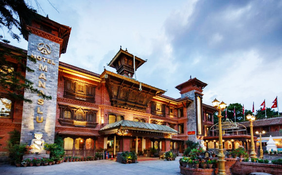
Manaslu Hotel
Hotel Manaslu located in the immaculate area of Lazimpat, Kathmandu is a heritage hotel established in 1972. We have kept the proud heritage of Nepal alive throughout its operation by offering unparalleled service and warm hospitality, that defines the values and culture of Nepal. The architecture of our hotel includes many ancient pieces that have been carefully restored and incorporated.
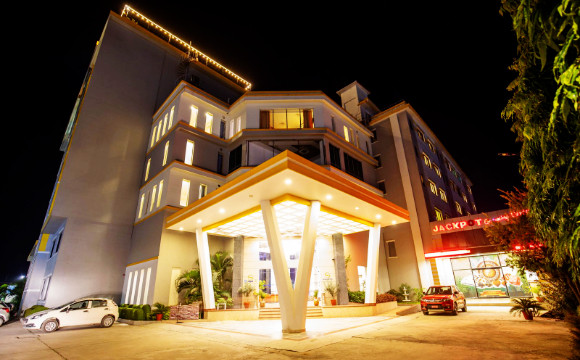
Siddhartha Hotel
Siddhartha Hotel is a Luxury Four Star property in Nepalgunj, with its multi storied building established in large area provides the magnificence of accommodation. This beautiful hotel is located between Ranjha Airport and Nepalgunj city, and offers a vast range of facilities such as luxury accommodation, restaurant, 24hrs room service, business center, fitness center, sauna, swimming pool, health club etc.

Camping Tent
Our classic A-frame or ridge tents are sturdy and have plenty of room for two people. We use water and windproof flysheet which help make the tent nice and cozy inside. To complete the setup we provide a high-quality form mattress together with an insulation pad so that you get a good sleep after a long tiring day.
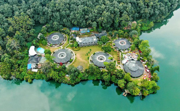
Fish Tail Lodge
Fish Tail Lodge enjoys a unique location situated on a peninsula across Fewa Lake. Shuttle-floats or boats transport you across to the resort. With the lake on one side and a forest hill on the other, the views are spectacular. The panorama of Annapurna range and Mount “Machhapuchre” (Fish Tail), and their reflection on the lake soothe your soul and refresh your spirit.